| http://dbpedia.org/ontology/PopulatedPlace/areaTotal
|
36.0
|
| http://dbpedia.org/ontology/abstract
|
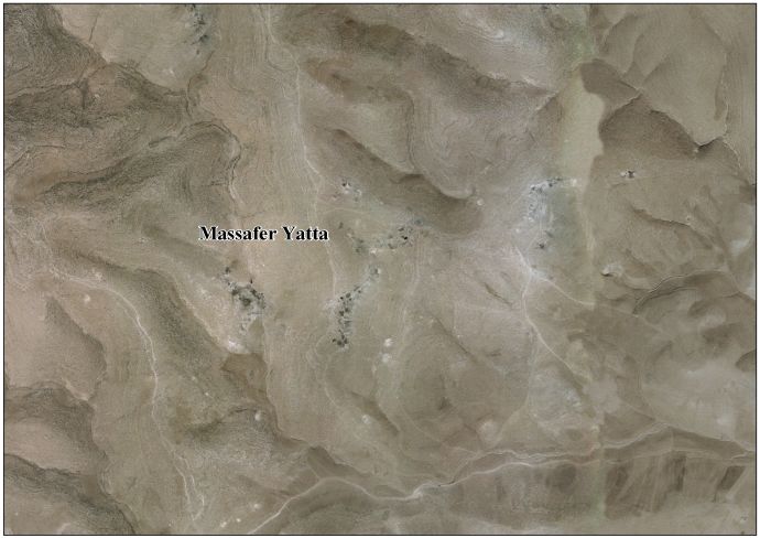
Masafer Yatta (Arabic: مسافر يطا, also spe … Masafer Yatta (Arabic: مسافر يطا, also spelled Mosfaret Yatta) is a collection of 19 Palestinian hamlets in the southern West Bank, in the Hebron Governorate of the State of Palestine, located between 14 and 24 kilometers south of the city of Hebron, in the southern Hebron Hills. The hamlets are situated within the municipal boundary of Yatta. The name "Masafer" is believed to derive from the Arabic words for "traveling," in light of the distance needed to travel from Yatta, or "nothing" in light of the local belief that "nothing" would be able to live in the area.othing" would be able to live in the area.
, مسافر يطا هي عبارة عن مجموعة من 19 قرية فل … مسافر يطا هي عبارة عن مجموعة من 19 قرية فلسطينية في محافظة الخليل جنوب الضفة الغربية، تقع بين 14 و24 كم جنوب مدينة الخليل. داخل حدود بلدية يطا. يُعتقد أن اسم «مسافر» مشتق من الكلمات العربية «السفر»، في ضوء المسافة اللازمة للسفر من يطا، أو بمعنى «لا شيء» في ضوء الاعتقاد المحلي بأن «لا شيء» سيكون قادرًا على العيش في المنطقة.لا شيء» سيكون قادرًا على العيش في المنطقة.
, Masafer Yatta (en árabe, مسافر يطا: يطا … Masafer Yatta (en árabe, مسافر يطا: يطا, alternativamente escrito como Mosfaret Yatta) es una serie de 19 aldeas palestinas en la Gobernación de Hebrón, en el extremo sur de Cisjordania, ubicada a unos 24 kilómetros al sur de la ciudad de Hebrón, justo en el borde palestino de la llamada Línea Verde de 1948, la frontera internacionalmente reconocida del Estado de Israel. La zona tiene una extensión de 36 kilómetros cuadrados, de los que 10,2 kilómetros cuadrados han sido confiscados por el ejército israelí, que ha declarado parte de su superficie como campo de tiro y prohíbe todo tipo de construcción en ellas, además de demoler numerosas casas y dejar impunes los incidentes violentos protagonizados por colonos en la mayoría de los casos. por colonos en la mayoría de los casos.
, Masafer Yatta (Arabe: مسافر يطا, s'épelle … Masafer Yatta (Arabe: مسافر يطا, s'épelle également Mosfaret Yatta) est une zone semi-désertique située dans le sud-est du district d'Hébron, en Cisjordanie. Elle abrite douze communautés palestiniennes qui vivent principalement de l'agriculture et de l'élevage. Elle s’étend sur une superficie de 30000 dounams et compte une population de 2 500 habitants répartis sur douze villages ou hameaux bédouins : Janba, Mafqara, Khallet al-Dabe’, Maghayer al-Ubaid, Asafat al-Fawqa, Asafat al-Tahta, Majaz, Tabban, Tuba, Fakheet, Halawa et Markaz. Les habitants de Masafer Yatta vivent depuis des décennies dans la crainte constante de perdre leurs maisons. Ils ont fait l'objet d'innombrables ordres de démolition et déplacements. En mai 2022, la Haute Cour de justice israélienne a statué que huit communautés pouvaient être expulsées de Masafer Yatta, déclarée "zone de tir 918" en 1981.Yatta, déclarée "zone de tir 918" en 1981.
, Masafer Yatta (àrab: مسافر يطا, Masāfir Ya … Masafer Yatta (àrab: مسافر يطا, Masāfir Yaṭṭā) són un grup de 19 llogarets palestins de la governació d'Hebron, a Cisjordània, situats entre 14 i 24 kilòmetres al sud-oest d'Hebron en els límits municipals de Yatta. Segons l'Oficina Central Palestina d'Estadístiques sis de les localitats que conformen Masafer Yatta (Mantiqat Shi'b al-Batim, Khirbet Tawil ash-Shih, Khirbet al-Fakhit, Khirbet Bir al-Idd, Khirbet Asafi i Maghayir al-Abeed) tenien una població de 768 habitants en 2007. la propera at-Tuwani serveix com a centre de les localitats beduïnes de Masafer Yatta. Masafer Yatta és administrat per un comitè de desenvolupament local els membres del qual són nomenats pel Ministeri d'Afers Locals de l'Autoritat Nacional Palestina. Es creu que el nom "Masafer" deriva de l'àrab "viatjar" per la distància necessària per viatjar des de Yatta, o "res" per la creença local que "res" podria viure a la zona.ça local que "res" podria viure a la zona.
|
| http://dbpedia.org/ontology/areaTotal
|
36000000
|
| http://dbpedia.org/ontology/country
|
http://dbpedia.org/resource/State_of_Palestine +
|
| http://dbpedia.org/ontology/governmentType
|
http://dbpedia.org/resource/Local_Development_Committee_%28Palestinian_Authority%29 +
|
| http://dbpedia.org/ontology/populationTotal
|
768
|
| http://dbpedia.org/ontology/subdivision
|
http://dbpedia.org/resource/Hebron_Governorate +
|
| http://dbpedia.org/ontology/thumbnail
|
http://commons.wikimedia.org/wiki/Special:FilePath/%D9%85%D8%B3%D8%A7%D9%81%D8%B1_%D9%8A%D8%B7%D8%A7.jpg?width=300 +
|
| http://dbpedia.org/ontology/wikiPageExternalLink
|
https://archive.org/details/surveyofwesternp03conduoft +
, http://vprofile.arij.org/hebron/images/Massafer%20Yatta%20Areal%20Photo.jpg +
, http://blog.eappi.org/tag/masafer-yatta/ +
, http://commons.wikimedia.org/wiki/File:Survey_of_Western_Palestine_1880.25.jpg +
, http://rhr.org.il/eng/tag/bir-el-id/ +
, http://www.taayush.org/%3Fcat=248 +
, https://archive.org/details/surveyofwesternp00conduoft +
, http://vprofile.arij.org/hebron/pdfs/At%20Tuwani%20&%20Mosafaret%20Yatta.pdf +
, http://www.iaa-archives.org.il/zoom/zoom.aspx%3Ffolder_id=93&type_id=6&id=8387 +
|
| http://dbpedia.org/ontology/wikiPageID
|
38361199
|
| http://dbpedia.org/ontology/wikiPageLength
|
14676
|
| http://dbpedia.org/ontology/wikiPageRevisionID
|
1124309119
|
| http://dbpedia.org/ontology/wikiPageWikiLink
|
http://dbpedia.org/resource/Arabic_script +
, http://dbpedia.org/resource/Artemisia_%28genus%29 +
, http://dbpedia.org/resource/At-Tuwani +
, http://dbpedia.org/resource/Israeli_settlement +
, http://dbpedia.org/resource/State_of_Palestine +
, http://dbpedia.org/resource/Palestine_grid +
, http://dbpedia.org/resource/Ta%27ayush +
, http://dbpedia.org/resource/Local_Development_Committee_%28Palestinian_Authority%29 +
, http://dbpedia.org/resource/Cistern +
, http://dbpedia.org/resource/Internet_Archive +
, http://dbpedia.org/resource/Hebron_Hills +
, http://dbpedia.org/resource/Palestine_Exploration_Fund +
, http://dbpedia.org/resource/Israel +
, http://dbpedia.org/resource/Water_well +
, http://dbpedia.org/resource/Samu_incident +
, http://dbpedia.org/resource/Hebron_Governorate +
, http://dbpedia.org/resource/Pistacia_palaestina +
, http://dbpedia.org/resource/Natan_Shalem +
, http://dbpedia.org/resource/Israeli_occupation_of_the_West_Bank +
, http://dbpedia.org/resource/Category:Villages_in_the_West_Bank +
, http://dbpedia.org/resource/Governorates_of_the_Palestinian_National_Authority +
, http://dbpedia.org/resource/Palestinian_Central_Bureau_of_Statistics +
, http://dbpedia.org/resource/As-Samu +
, http://dbpedia.org/resource/Area_C_%28West_Bank%29 +
, http://dbpedia.org/resource/Applied_Research_Institute%E2%80%93Jerusalem +
, http://dbpedia.org/resource/Category:Hebron_Governorate +
, http://dbpedia.org/resource/Dolev +
, http://dbpedia.org/resource/File:Massafer_Yatta.jpg +
, http://dbpedia.org/resource/File:Settlers_attack_on_Al-Mufakara_October_2021.jpg +
, http://dbpedia.org/resource/Mitzpeh_Yair +
, http://dbpedia.org/resource/File:%D7%94%D7%94%D7%AA%D7%A7%D7%A4%D7%94_%D7%A2%D7%9C_%D7%97%D7%99%D7%A8%D7%91%D7%AA_%D7%90%D7%9C_%D7%9E%D7%95%D7%A4%D7%A7%D7%A8%D7%94_%D7%91%D7%90%D7%A1%D7%9C_%D7%90%D7%9C_%D7%A2%D7%93%D7%A8%D7%94.jpg +
, http://dbpedia.org/resource/Yair_Lapid +
, http://dbpedia.org/resource/Rabbis_for_Human_Rights +
, http://dbpedia.org/resource/Latin_script +
, http://dbpedia.org/resource/Arabic_language +
, http://dbpedia.org/resource/Six-Day_War +
, http://dbpedia.org/resource/Ariel_Sharon +
, http://dbpedia.org/resource/Palestinian_National_Authority +
, http://dbpedia.org/resource/Palestinians +
, http://dbpedia.org/resource/West_Bank +
, http://dbpedia.org/resource/Ecumenical_Accompaniment_Programme_in_Palestine_and_Israel +
, http://dbpedia.org/resource/Israeli_settler_violence +
, http://dbpedia.org/resource/David_Mintz_%28judge%29 +
, http://dbpedia.org/resource/The_Guardian +
, http://dbpedia.org/resource/Yatta%2C_Hebron +
, http://dbpedia.org/resource/Bedouin +
, http://dbpedia.org/resource/Hebron +
|
| http://dbpedia.org/property/areaTotalDunam
|
36000
|
| http://dbpedia.org/property/areaTotalKm
|
36
|
| http://dbpedia.org/property/blankInfoSec
|
"Traveling" or "Nothing"
|
| http://dbpedia.org/property/blankNameSec
|
Name meaning
|
| http://dbpedia.org/property/establishedTitle
|
Founded
|
| http://dbpedia.org/property/governmentType
|
http://dbpedia.org/resource/Local_Development_Committee_%28Palestinian_Authority%29 +
|
| http://dbpedia.org/property/gridName
|
http://dbpedia.org/resource/Palestine_grid +
|
| http://dbpedia.org/property/imageCaption
|
Masafer Yatta
|
| http://dbpedia.org/property/imageSkyline
|
مسافر يطا.jpg
|
| http://dbpedia.org/property/name
|
Masafer Yatta
|
| http://dbpedia.org/property/populationAsOf
|
2007
|
| http://dbpedia.org/property/populationDensityKm
|
auto
|
| http://dbpedia.org/property/populationTotal
|
768
|
| http://dbpedia.org/property/pushpinMap
|
Palestine
|
| http://dbpedia.org/property/pushpinMapCaption
|
Location of Masafer Yatta within Palestine
|
| http://dbpedia.org/property/subdivisionName
|
http://dbpedia.org/resource/Hebron_Governorate +
, http://dbpedia.org/resource/State_of_Palestine +
|
| http://dbpedia.org/property/subdivisionType
|
http://dbpedia.org/resource/Governorates_of_the_Palestinian_National_Authority +
, State
|
| http://dbpedia.org/property/translitLang
|
Arabic
|
| http://dbpedia.org/property/translitLang1Info
|
مسافر يطا
, Mosfaret Yatta
|
| http://dbpedia.org/property/translitLang1Type
|
http://dbpedia.org/resource/Latin_script +
, http://dbpedia.org/resource/Arabic_script +
|
| http://dbpedia.org/property/type
|
http://dbpedia.org/resource/Local_Development_Committee_%28Palestinian_Authority%29 +
|
| http://dbpedia.org/property/unitPref
|
dunam
|
| http://dbpedia.org/property/wikiPageUsesTemplate
|
http://dbpedia.org/resource/Template:Reflist +
, http://dbpedia.org/resource/Template:Infobox_settlement +
, http://dbpedia.org/resource/Template:Short_description +
, http://dbpedia.org/resource/Template:Use_dmy_dates +
, http://dbpedia.org/resource/Template:Hebron_Governorate +
, http://dbpedia.org/resource/Template:Refend +
, http://dbpedia.org/resource/Template:Refbegin +
, http://dbpedia.org/resource/Template:Coord +
, http://dbpedia.org/resource/Template:Cite_book +
|
| http://purl.org/dc/terms/subject
|
http://dbpedia.org/resource/Category:Hebron_Governorate +
, http://dbpedia.org/resource/Category:Villages_in_the_West_Bank +
|
| http://purl.org/linguistics/gold/hypernym
|
http://dbpedia.org/resource/Collection +
|
| http://www.georss.org/georss/point
|
31.38 35.18083333333333
|
| http://www.w3.org/2003/01/geo/wgs84 pos#geometry
|
POINT(35.18083190918 31.379999160767)
|
| http://www.w3.org/2003/01/geo/wgs84 pos#lat
|
31.379999160767
|
| http://www.w3.org/2003/01/geo/wgs84 pos#long
|
35.18083190918
|
| http://www.w3.org/ns/prov#wasDerivedFrom
|
http://en.wikipedia.org/wiki/Masafer_Yatta?oldid=1124309119&ns=0 +
|
| http://xmlns.com/foaf/0.1/depiction
|
http://commons.wikimedia.org/wiki/Special:FilePath/%D9%85%D8%B3%D8%A7%D9%81%D8%B1_%D9%8A%D8%B7%D8%A7.jpg +
, http://commons.wikimedia.org/wiki/Special:FilePath/Massafer_Yatta.jpg +
, http://commons.wikimedia.org/wiki/Special:FilePath/Settlers_attack_on_Al-Mufakara_October_2021.jpg +
, http://commons.wikimedia.org/wiki/Special:FilePath/%D7%94%D7%94%D7%AA%D7%A7%D7%A4%D7%94_%D7%A2%D7%9C_%D7%97%D7%99%D7%A8%D7%91%D7%AA_%D7%90%D7%9C_%D7%9E%D7%95%D7%A4%D7%A7%D7%A8%D7%94_%D7%91%D7%90%D7%A1%D7%9C_%D7%90%D7%9C_%D7%A2%D7%93%D7%A8%D7%94.jpg +
|
| http://xmlns.com/foaf/0.1/isPrimaryTopicOf
|
http://en.wikipedia.org/wiki/Masafer_Yatta +
|
| http://xmlns.com/foaf/0.1/name
|
Masafer Yatta
|
| owl:sameAs |
http://he.dbpedia.org/resource/%D7%9E%D7%A1%D7%90%D7%A4%D7%A8_%D7%99%D7%98%D7%90 +
, http://es.dbpedia.org/resource/Masafer_Yatta +
, http://arz.dbpedia.org/resource/%D9%85%D8%B3%D8%A7%D9%81%D8%B1_%D9%8A%D8%B7%D8%A7 +
, http://yago-knowledge.org/resource/Masafer_Yatta +
, http://rdf.freebase.com/ns/m.0qfqmzy +
, http://www.wikidata.org/entity/Q6782301 +
, http://ca.dbpedia.org/resource/Masafer_Yatta +
, http://fr.dbpedia.org/resource/Masafer_Yatta +
, https://global.dbpedia.org/id/4rKaa +
, http://dbpedia.org/resource/Masafer_Yatta +
, http://ar.dbpedia.org/resource/%D9%85%D8%B3%D8%A7%D9%81%D8%B1_%D9%8A%D8%B7%D8%A7 +
|
| rdf:type |
http://schema.org/Place +
, http://dbpedia.org/class/yago/Municipality108626283 +
, http://dbpedia.org/class/yago/UrbanArea108675967 +
, http://dbpedia.org/ontology/Book +
, http://dbpedia.org/class/yago/Object100002684 +
, http://dbpedia.org/class/yago/Region108630985 +
, http://dbpedia.org/ontology/Location +
, http://dbpedia.org/class/yago/GeographicalArea108574314 +
, http://www.wikidata.org/entity/Q486972 +
, http://dbpedia.org/ontology/Place +
, http://www.w3.org/2003/01/geo/wgs84_pos#SpatialThing +
, http://dbpedia.org/ontology/Settlement +
, http://dbpedia.org/class/yago/Settlement108672562 +
, http://dbpedia.org/class/yago/Location100027167 +
, http://dbpedia.org/class/yago/District108552138 +
, http://dbpedia.org/class/yago/Village108672738 +
, http://dbpedia.org/class/yago/YagoLegalActorGeo +
, http://dbpedia.org/class/yago/PhysicalEntity100001930 +
, http://dbpedia.org/class/yago/AdministrativeDistrict108491826 +
, http://dbpedia.org/ontology/PopulatedPlace +
, http://dbpedia.org/class/yago/YagoGeoEntity +
, http://dbpedia.org/class/yago/WikicatVillagesInTheWestBank +
, http://dbpedia.org/class/yago/YagoPermanentlyLocatedEntity +
|
| rdfs:comment |
Masafer Yatta (en árabe, مسافر يطا: يطا … Masafer Yatta (en árabe, مسافر يطا: يطا, alternativamente escrito como Mosfaret Yatta) es una serie de 19 aldeas palestinas en la Gobernación de Hebrón, en el extremo sur de Cisjordania, ubicada a unos 24 kilómetros al sur de la ciudad de Hebrón, justo en el borde palestino de la llamada Línea Verde de 1948, la frontera internacionalmente reconocida del Estado de Israel. La zona tiene una extensión de 36 kilómetros cuadrados, de los que 10,2 kilómetros cuadrados han sido confiscados por el ejército israelí, que ha declarado parte de su superficie como campo de tiro y prohíbe todo tipo de construcción en ellas, además de demoler numerosas casas y dejar impunes los incidentes violentos protagonizados por colonos en la mayoría de los casos. por colonos en la mayoría de los casos.
, Masafer Yatta (Arabic: مسافر يطا, also spe … Masafer Yatta (Arabic: مسافر يطا, also spelled Mosfaret Yatta) is a collection of 19 Palestinian hamlets in the southern West Bank, in the Hebron Governorate of the State of Palestine, located between 14 and 24 kilometers south of the city of Hebron, in the southern Hebron Hills. The hamlets are situated within the municipal boundary of Yatta. The name "Masafer" is believed to derive from the Arabic words for "traveling," in light of the distance needed to travel from Yatta, or "nothing" in light of the local belief that "nothing" would be able to live in the area.othing" would be able to live in the area.
, مسافر يطا هي عبارة عن مجموعة من 19 قرية فل … مسافر يطا هي عبارة عن مجموعة من 19 قرية فلسطينية في محافظة الخليل جنوب الضفة الغربية، تقع بين 14 و24 كم جنوب مدينة الخليل. داخل حدود بلدية يطا. يُعتقد أن اسم «مسافر» مشتق من الكلمات العربية «السفر»، في ضوء المسافة اللازمة للسفر من يطا، أو بمعنى «لا شيء» في ضوء الاعتقاد المحلي بأن «لا شيء» سيكون قادرًا على العيش في المنطقة.لا شيء» سيكون قادرًا على العيش في المنطقة.
, Masafer Yatta (àrab: مسافر يطا, Masāfir Ya … Masafer Yatta (àrab: مسافر يطا, Masāfir Yaṭṭā) són un grup de 19 llogarets palestins de la governació d'Hebron, a Cisjordània, situats entre 14 i 24 kilòmetres al sud-oest d'Hebron en els límits municipals de Yatta. Segons l'Oficina Central Palestina d'Estadístiques sis de les localitats que conformen Masafer Yatta (Mantiqat Shi'b al-Batim, Khirbet Tawil ash-Shih, Khirbet al-Fakhit, Khirbet Bir al-Idd, Khirbet Asafi i Maghayir al-Abeed) tenien una població de 768 habitants en 2007. la propera at-Tuwani serveix com a centre de les localitats beduïnes de Masafer Yatta. Masafer Yatta és administrat per un comitè de desenvolupament local els membres del qual són nomenats pel Ministeri d'Afers Locals de l'Autoritat Nacional Palestina. Locals de l'Autoritat Nacional Palestina.
, Masafer Yatta (Arabe: مسافر يطا, s'épelle … Masafer Yatta (Arabe: مسافر يطا, s'épelle également Mosfaret Yatta) est une zone semi-désertique située dans le sud-est du district d'Hébron, en Cisjordanie. Elle abrite douze communautés palestiniennes qui vivent principalement de l'agriculture et de l'élevage. Elle s’étend sur une superficie de 30000 dounams et compte une population de 2 500 habitants répartis sur douze villages ou hameaux bédouins : Janba, Mafqara, Khallet al-Dabe’, Maghayer al-Ubaid, Asafat al-Fawqa, Asafat al-Tahta, Majaz, Tabban, Tuba, Fakheet, Halawa et Markaz., Tabban, Tuba, Fakheet, Halawa et Markaz.
|
| rdfs:label |
مسافر يطا
, Masafer Yatta
|